 |
| A common scenario around here- White Rock quadrant topo map laid out in front of wood stove for studying |
Nothing could challenge my sense of directions more than making my home in these mountains. The terrain dips and curves and you lose sight of this and find yourself around the bend gazing upon that. The only comfort for a directionally challenged person such as myself is the age old rule of "if you go keep going downhill you will eventually come to water." Following bodies of water always leads to a branch or, if you're really lost, the river. In this day and age there are so many roads cutting through the land, even through this remote section of Appalachia, that I have never had to go all the way to the river to get my bearings. But I have had to stop someone on the road and ask about just exactly where I was...
Needless to say, figuring out just exactly where I am in relation to other places where I might sometimes be takes me a whole lot of studying. Now that I have a home of my own, I am more determined than ever to get some inking of a bearing. I've been spending a lot of time studying on the topo maps I have and walking- starting at the house and going in each direction to just get my bearings. Believe it or not, even walking the property line can be confusing. (It's a pretty great problem to have!)
This morning I walked the property line to see what mountains I could see to the west, and then again to the east and to the north. To the west is Rich Mountain and Mill Ridge and the road that goes to my family in Hot Springs. I can see it in the distance from part of one of the ridges of my property line. To the east and north is Sapling Mountain, which divides Chapel Hill from Big Laurel valley. To the north is Franklin Mountain, which divides 212 from 208 (on the way to Greeneville).
 |
| Sunrise casting shadows over the west side of Sapling Mountain |
 |
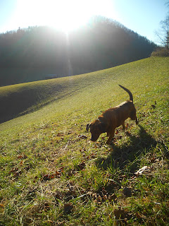
| Hopey is hard-wired to know where she's at |
When I meditate on getting my bearings, what I end up pondering about ends up being more complex than merely figuring out which gorgeous mountain I can view from which vantage points. It is more complex than learning which trees flower or fruit during which weeks of which months and which mosses send up spores in November. In this modern era of fast paced movement and seemingly limitless access to world-wide information, I find it increasingly difficult to keep track of my bearings. How exactly am I fitting into this world I live in? What is my relation to this technology or that strange modern custom? Should I go down this road with the rest of them to stay connected to my species, or will we all find ourselves too far away from the water because we forgot to follow the first rule of being lost? I think I will spend my entire life trying to get my bearings. Does that seem tedious? I think it's exciting. For example...
 |
| Who knew this club moss was sporing out in November?
|
4 comments:
Dana, I never would have guessed this about you! Ever an enigma...
I know what you mean about the locals' knowing everywhere. Conjures up memories of looking up at a Union County local boy tellin' about the location of things directionally from a creek, or "Down yonder" a certain paved or gravel country road. In WV they call 'em "hard roads" when they are paved. Does your local brand of hillbilly call 'em that? That's the very type thing that I'm fascinated with.
Dana,
Maybe you should do a 'getting my bearings' workday; have other people exploring for you and make a happening out of it. Send out your friends in the four directions and have them telling their story around a camp fire.
yeha, I am in...
all i gotta say is "East Canton baby".
the part especially at the end-this really resonates with questions eduard and i talk a lot about. it is a big part of why gardening and farming is so attractive to me. it feels real.
Post a Comment